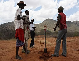
The Land Potential Knowledge System (LandPKS) is a suite of integrated, modular apps connected to cloud-based analytics and user-accessible cloud storage that will allow users to access share and interpret global knowledge and information relevant to the unique potential of each piece of land. LandPKS recently released two android based apps which are available for download on Google Play; Landinfo and Landcover apps.
The mobile phone apps exploit the latest in digital soil mapping, GPS-enabled camera functions and other cloud-computing technology and require no special training thanks to picture-matching, drop-down menus, video explanations, and multiple-choice questions. Design modifications are on-going, and are implemented based on user feedback.
The Landinfo app primary objective is to make collecting soil data easier for non-soil scientists; however, the app provide some useful feedback, including how much water the soil can store for plants to use, average monthly temperature and precipitation, and the length of the growing season based on the user’s location. LandPKS will integrate the user observations with global database indicators to provide inputs to our cloud-based analytic system resulting in site specific estimates for land productivity, soil erosion potential and resilience.
Landcover app simplifies collecting data for land-cover inventories and monitoring. In fact, a yard or meter stick with five notches is all that’s needed to document tree, grass, bare ground and crop-residue cover. The app automatically generates basic indicators of these cover types on the phone. Once a connection is established, the app sends the data to servers, where it will be stored and accessible to users worldwide.
The LandPKS data portal provides user data via simple spread sheets, as well as visualization tools to display data graphically. While LandPKS tools are currently being tested in Kenya and Namibia, the tools have been structured for use across the globe. Read More