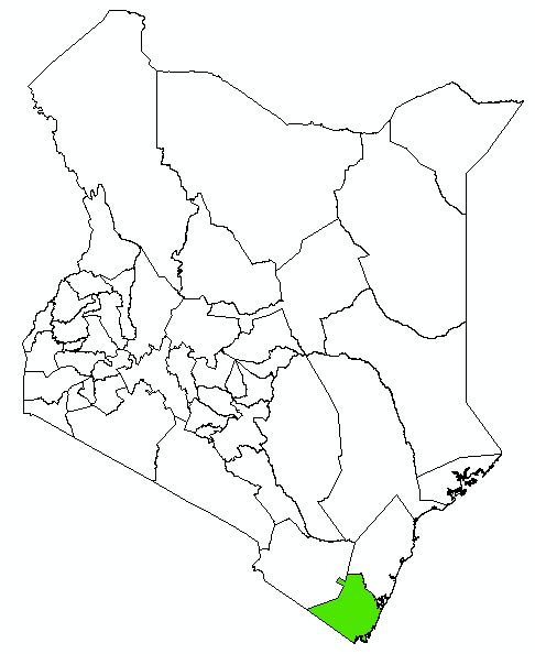
Kwale County: Background Information
Kwale County is one of the six Counties in the coastal region. The headquarters of the County is Kwaletown. It borders Taita Taveta County to the NorthWest, Kilifi County to the North East, Taita Taveta and Kilifito the North, Mombasa County and Indian Ocean to theEast and United Republic of Tanzania to the South (KwaleCIDP, 2013).
The County is located in the South-easterncorner of Kenya and covers an area of 8270.2 Km², of which 62 Km2 isunder water (Kwale CIDP, 2013). The area excludes the 200-miles coastal strip known as the Exclusive Economic Zones (EEZ). The County comprises of four Sub-counties;Kinango, Lunga lunga, Matuga and Msambweni (KwaleCounty Government).
August is the coolest in the year (Kwale CIDP, 2013). Rainfall is bi-modal with short rains from October to December,while the long rains are experienced from March/Aprilto July (Kwale CIDP, 2013). The total annual precipitation varies from 900mm–1500mm per annum along the coast to 500mm to 600mm per annum in the hinterland (KwaleCIDP, 2013). The average annual rainfall ranges from 600mm in the hinterland to 1200mm at the coastal belt (KwaleCIDP, 2013). The coastal belt receives an average annual rainfall of a 1000mm with a marked decrease in intensity tothe north and the hinterland (Kwale CIDP, 2013).
Average temperature ranges from 26.30C to 26.60C in the coastal lowlands, 250C to 26.60C in Shimba Hills, and 24.6C in the hinterland (Kwale CIDP, 2013). According to the 2009 census the population of Kwale was 649, 931 comprising of 315, 997 males and 333, 934 females (KNBS, 2010). Projections indicate that by 2017 the population of the County will be 833, 527 with 405,262 males and 428,266 females (KNBS, 2010).
